The Church of St.Anna
- The Church of St.Anna
- Tisá Walls
- Promenade Walk “Perthenova cesta”
- The Memorial of the Victims of World War I.
- Tourist Cabin
- Kačák pond
- Cihlák pond
- Neuber’s Runied Tower
- Klement’s Cross
- Rájec Settlement
- The Chapel in Rájec
- A Monument Dedicated to Rock Climbers
- Ostrov
- The Cross at the Mill
- Iron Path (Železná cesta)
- The Rock Crevasse – Zwergloch (Dwarf’s cave)
- Border Stones – Ostrov
- Ostrov Spring
- Děčínský Sněžník
- Poor Sinner’s Cross
- Botschen Family Crypt
Interaktivní mapa
Můžete si otevřít mapu na mapy.cz a uložit do batůžku.
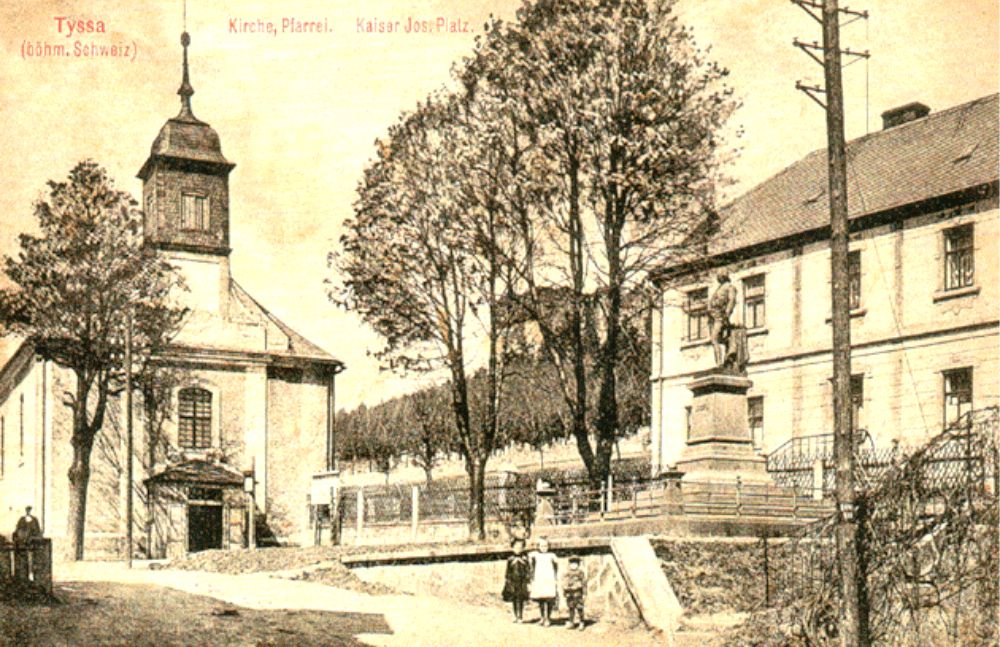
This church was built in 1789.
Its building was co-funded by the Catholic Church, the Thun family, local citizens and even the Emperor Josef II. himself, who was also present at the laying of the foundation stone in 1779. The emperor’s statue was later added in front of the church. It was removed in 1919.
The organ-loft contains 18th century organs, the instrument of Heinrich Schiffner from 1888. The bell-tower contains two cast-iron bells manufactured in 1922 by Arnold-Kress steelworks in Chabařovice and a small bell from 1859 by František Herold from Litoměřice. There is an angle-shaped font in the church, which originally comes from another church in an abandoned settlement of Schönstein.
N:50°47.144´ E:014°01.756´
The Church of St.Anna
Tisá Walls
- The Church of St.Anna
- Tisá Walls
- Promenade Walk “Perthenova cesta”
- The Memorial of the Victims of World War I.
- Tourist Cabin
- Kačák pond
- Cihlák pond
- Neuber’s Runied Tower
- Klement’s Cross
- Rájec Settlement
- The Chapel in Rájec
- A Monument Dedicated to Rock Climbers
- Ostrov
- The Cross at the Mill
- Iron Path (Železná cesta)
- The Rock Crevasse – Zwergloch (Dwarf’s cave)
- Border Stones – Ostrov
- Ostrov Spring
- Děčínský Sněžník
- Poor Sinner’s Cross
- Botschen Family Crypt
Interaktivní mapa
Můžete si otevřít mapu na mapy.cz a uložit do batůžku.
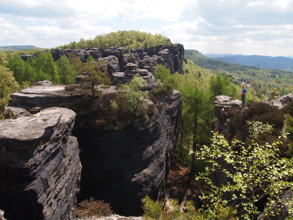
The rock town is 99,56 ha
Large and is represented by monumental, up to 30 m high walls oriented southwards into the open land with the view of the Central Bohemian Highlands. Its highest point reaches the elevation of 613 meters for almost one kilometer. Behind these walls there is a labyrinth of rock towers and spikes with honeycombs, rock windows and portals, which create a dense network of narrow passages and gorges with wider areas.
The tourist circuits lead across the Great Walls (Velké skály) and Little Walls (Malé skály). The first circuit leads through the rock town up to the restaurant and the Tourist Cabin (Turistická chata). From there it leads across a rocky range with beautiful vistas into the surrounding lands. Going backwards you can trace your way back to the starting point. You can head out for the small circuit. The trail leads through passages among the rocks to the vistas again and then back to the cabin on the rocky square. The big circuit takes approx. 90 minutes; the small circuit takes approx. 45 minutes. You can also start the long circuit at the entrance to the rocks near the Tourist Cabin.
Ticket box - N:50°47.263´ E:014°01.731´
Tisá Walls
Promenade Walk "Perthenova cesta"
- The Church of St.Anna
- Tisá Walls
- Promenade Walk “Perthenova cesta”
- The Memorial of the Victims of World War I.
- Tourist Cabin
- Kačák pond
- Cihlák pond
- Neuber’s Runied Tower
- Klement’s Cross
- Rájec Settlement
- The Chapel in Rájec
- A Monument Dedicated to Rock Climbers
- Ostrov
- The Cross at the Mill
- Iron Path (Železná cesta)
- The Rock Crevasse – Zwergloch (Dwarf’s cave)
- Border Stones – Ostrov
- Ostrov Spring
- Děčínský Sněžník
- Poor Sinner’s Cross
- Botschen Family Crypt
Interaktivní mapa
Můžete si otevřít mapu na mapy.cz a uložit do batůžku.
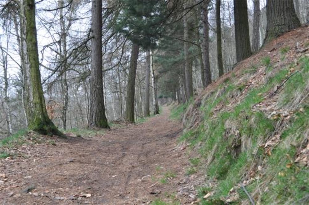
It leads from the path into the rocks
Above the Memorial of the Victims of World War I, under the walls up to the path leading to the Tourist Cabin (Turistická chata) at the eastern end of the village. It was built in 1920 and it was later repeatedly refurbished.
It was named after Herman Perthen, a native of Tisá, who was a major contributor to the building of this path.
N:50°47.215´ E:014°01.764´
Promenade Walk "Perthenova cesta"
The Memorial of the Victims of World War I.
- The Church of St.Anna
- Tisá Walls
- Promenade Walk “Perthenova cesta”
- The Memorial of the Victims of World War I.
- Tourist Cabin
- Kačák pond
- Cihlák pond
- Neuber’s Runied Tower
- Klement’s Cross
- Rájec Settlement
- The Chapel in Rájec
- A Monument Dedicated to Rock Climbers
- Ostrov
- The Cross at the Mill
- Iron Path (Železná cesta)
- The Rock Crevasse – Zwergloch (Dwarf’s cave)
- Border Stones – Ostrov
- Ostrov Spring
- Děčínský Sněžník
- Poor Sinner’s Cross
- Botschen Family Crypt
Interaktivní mapa
Můžete si otevřít mapu na mapy.cz a uložit do batůžku.
At the path towards the entrance to the rocks
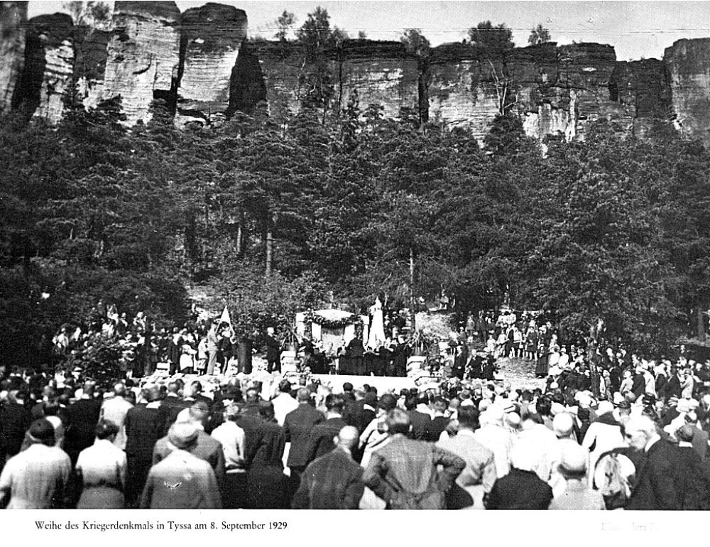
Above the cemetery, there is a Memorial of the Victims of World War I. 81 men from Tisá did not return from this war. The memorial was exhibited on the 8th of September 1929. After 1945 it was damaged and was not maintained for a long time.
The renovation of the memorial and its vicinity did not start until 2014. In 2014-2016 the access path to the rocks, leading along the cemetery, was renovated, linden trees were planted and information boards were placed along the path.
N:50°47.200´ E:014°01.794´
The Memorial of the Victims
Tourist Cabin
- The Church of St.Anna
- Tisá Walls
- Promenade Walk “Perthenova cesta”
- The Memorial of the Victims of World War I.
- Tourist Cabin
- Kačák pond
- Cihlák pond
- Neuber’s Runied Tower
- Klement’s Cross
- Rájec Settlement
- The Chapel in Rájec
- A Monument Dedicated to Rock Climbers
- Ostrov
- The Cross at the Mill
- Iron Path (Železná cesta)
- The Rock Crevasse – Zwergloch (Dwarf’s cave)
- Border Stones – Ostrov
- Ostrov Spring
- Děčínský Sněžník
- Poor Sinner’s Cross
- Botschen Family Crypt
Interaktivní mapa
Můžete si otevřít mapu na mapy.cz a uložit do batůžku.
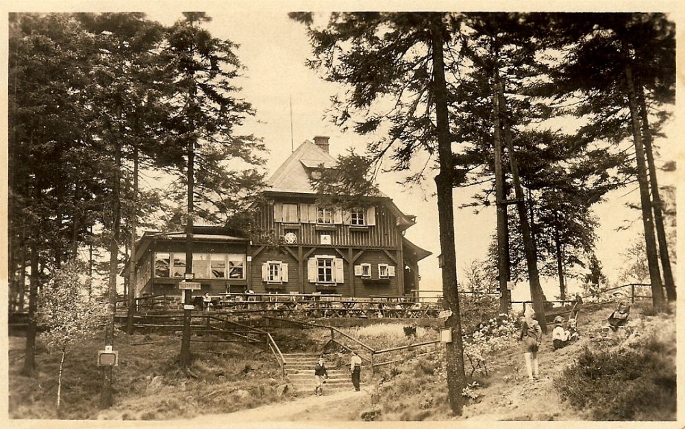
A restaurant and a guest-house
The cabin was built in 1926. Before the cabin there used to be a stall down at the road offering various snacks called “Jenseits” (on the other side) from 1908.
The dining halls show the fragments of a painting depicting humorous hunting scenes. These paintings were made by the renowned artist Franz Gruss /1891 - 1979/. Several painting were abolished during the reconstruction of the cabin.
N:50°47.273´ E:014°02.389´
Tourist Cabin
Kačák pond
- The Church of St.Anna
- Tisá Walls
- Promenade Walk “Perthenova cesta”
- The Memorial of the Victims of World War I.
- Tourist Cabin
- Kačák pond
- Cihlák pond
- Neuber’s Runied Tower
- Klement’s Cross
- Rájec Settlement
- The Chapel in Rájec
- A Monument Dedicated to Rock Climbers
- Ostrov
- The Cross at the Mill
- Iron Path (Železná cesta)
- The Rock Crevasse – Zwergloch (Dwarf’s cave)
- Border Stones – Ostrov
- Ostrov Spring
- Děčínský Sněžník
- Poor Sinner’s Cross
- Botschen Family Crypt
Interaktivní mapa
Můžete si otevřít mapu na mapy.cz a uložit do batůžku.
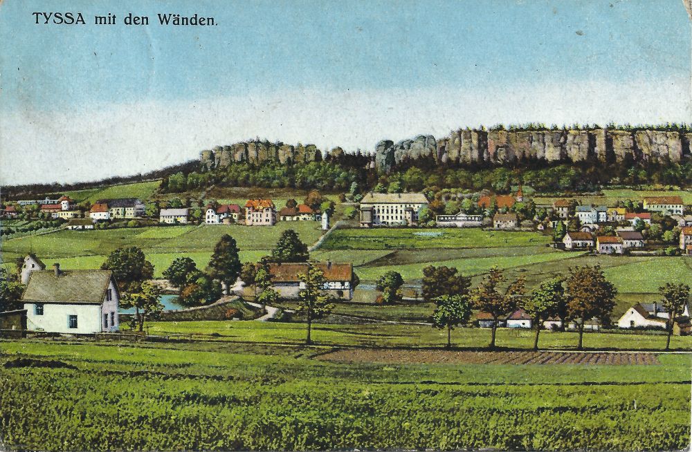
Originally a Mill Pond
This pond was constructed in the middle of the 18th century as a water cistern for two mills. It used to be called “Mlýnský rybník” (Mill Pond). After the abolishment of the mills in 1965 the pond was reconstructed into a recreation place as a replacement for “Cihlák” pond which was seized by the military. The contemporary name “Kačák” was adopted at that time. Next to the body of water there is a restaurant of the same name, which also underwent a lot of changes.
N: 50°46.912´ E: 014°01.513´
Kačák Pond
Cihlák pond
- The Church of St.Anna
- Tisá Walls
- Promenade Walk “Perthenova cesta”
- The Memorial of the Victims of World War I.
- Tourist Cabin
- Kačák pond
- Cihlák pond
- Neuber’s Runied Tower
- Klement’s Cross
- Rájec Settlement
- The Chapel in Rájec
- A Monument Dedicated to Rock Climbers
- Ostrov
- The Cross at the Mill
- Iron Path (Železná cesta)
- The Rock Crevasse – Zwergloch (Dwarf’s cave)
- Border Stones – Ostrov
- Ostrov Spring
- Děčínský Sněžník
- Poor Sinner’s Cross
- Botschen Family Crypt
Interaktivní mapa
Můžete si otevřít mapu na mapy.cz a uložit do batůžku.
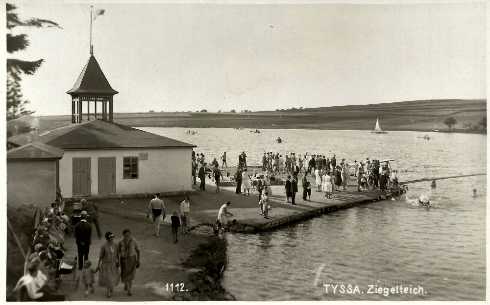
Another popular place for recreation
A pond established by the knights of Bünau for economic purposes. Due to its area of approx. 4 ha it is the largest pond around. There used to be Schönstein castle here, but it was destroyed during the Thirty Years’ War. This place was busy in the first half of the previous century, as the pond served as a natural swimming pool.
People could rent boats, paddle boats or yachts. There used to be a diving tower, a water slide and a restaurant with funny mushroom-style furniture.
The hotel proprietor, Anton Habel, also offered accommodation here in wooden shacks. The summer restaurant at the Cihlářský Pond was destroyed together with the whole recreation area by the Soviet Army in 1945.
N: 50°46'24.148" , E: 014°0'50.128"
Cihlák pond
Neuber’s Runied Tower
- The Church of St.Anna
- Tisá Walls
- Promenade Walk “Perthenova cesta”
- The Memorial of the Victims of World War I.
- Tourist Cabin
- Kačák pond
- Cihlák pond
- Neuber’s Runied Tower
- Klement’s Cross
- Rájec Settlement
- The Chapel in Rájec
- A Monument Dedicated to Rock Climbers
- Ostrov
- The Cross at the Mill
- Iron Path (Železná cesta)
- The Rock Crevasse – Zwergloch (Dwarf’s cave)
- Border Stones – Ostrov
- Ostrov Spring
- Děčínský Sněžník
- Poor Sinner’s Cross
- Botschen Family Crypt
Interaktivní mapa
Můžete si otevřít mapu na mapy.cz a uložit do batůžku.
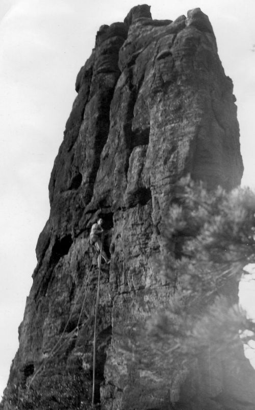
A high sandstone tower
That used to stand at the western end of Bürschlické Walls collapsed on the 5th of December 1981. It collapsed onto the slope due to climatic influences and broke down into several parts. The collapse was felt by the inhabitants of Tisá as a small earthquake. The tower was first scaled on the 24th of April, 1910, by Saxon climber Hans Neuber.
N: 50°47.627´ E: 014°01.831´
Neuber’s Runied Tower
Klement’s Cross
- The Church of St.Anna
- Tisá Walls
- Promenade Walk “Perthenova cesta”
- The Memorial of the Victims of World War I.
- Tourist Cabin
- Kačák pond
- Cihlák pond
- Neuber’s Runied Tower
- Klement’s Cross
- Rájec Settlement
- The Chapel in Rájec
- A Monument Dedicated to Rock Climbers
- Ostrov
- The Cross at the Mill
- Iron Path (Železná cesta)
- The Rock Crevasse – Zwergloch (Dwarf’s cave)
- Border Stones – Ostrov
- Ostrov Spring
- Děčínský Sněžník
- Poor Sinner’s Cross
- Botschen Family Crypt
Interaktivní mapa
Můžete si otevřít mapu na mapy.cz a uložit do batůžku.
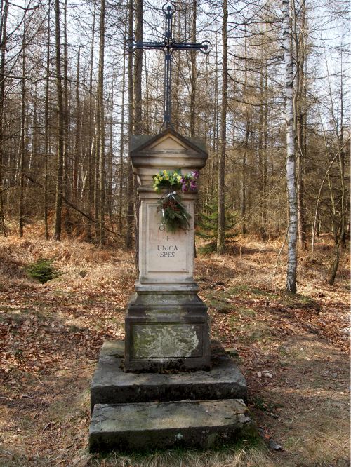
It is located at the road from Tisá to Rájec
At a place formerly called "Schaafschlichte" in the form of a modern forged cross inserted into a sandstone plinth.
This cross was built in 1874 from an inheritance of Wenzel Klement from Rájec No. 33 (150 guldens for building the cross, 50 guldens as maintenance capital) – probably at a place, where the founder had the painting of The Holy Trinity painted by artist Ferdinand Brinbaum from Jiřetín in 1873. The last renovation of the cross took place in 1996 (by Jan Pokorný, from Děčín).
N: 50°47.678´ E: 014°01.460´
Klement’s Cross
Rájec Settlement
- The Church of St.Anna
- Tisá Walls
- Promenade Walk “Perthenova cesta”
- The Memorial of the Victims of World War I.
- Tourist Cabin
- Kačák pond
- Cihlák pond
- Neuber’s Runied Tower
- Klement’s Cross
- Rájec Settlement
- The Chapel in Rájec
- A Monument Dedicated to Rock Climbers
- Ostrov
- The Cross at the Mill
- Iron Path (Železná cesta)
- The Rock Crevasse – Zwergloch (Dwarf’s cave)
- Border Stones – Ostrov
- Ostrov Spring
- Děčínský Sněžník
- Poor Sinner’s Cross
- Botschen Family Crypt
Interaktivní mapa
Můžete si otevřít mapu na mapy.cz a uložit do batůžku.
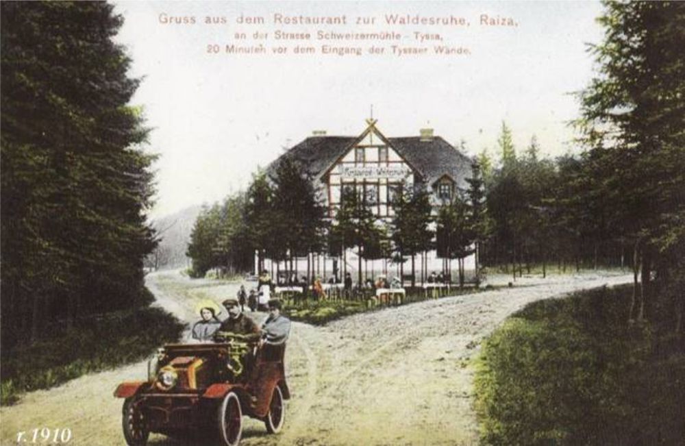
Recreation settlement close to the borders.(485 m above sea level).
Its name Raiza (Rájec) dates back to 1186. The village has belonged to Tisá since 1850 and it used to be settled by button factory workers in Tisá, forest workers and craftsmen. The village has retained several half-timbered frame houses no.5, 35, 36, 42, which are protected by the government as cultural monuments. The right side of the valley is flanked by sandstone rocks.
There are protected wetlands within the settlement. In the past, Rájec used to be quite a large village. The village used to have an independent part of nowadays nonexistent Nové Dvory and Hladov tenement estate.
The village is connected by a road with newly finished surface suitable for cycling, in-line skating and skateboarding.
N: 50°48.359´ E: 014°01.018´
Rájec Settlement
The Chapel in Rájec
- The Church of St.Anna
- Tisá Walls
- Promenade Walk “Perthenova cesta”
- The Memorial of the Victims of World War I.
- Tourist Cabin
- Kačák pond
- Cihlák pond
- Neuber’s Runied Tower
- Klement’s Cross
- Rájec Settlement
- The Chapel in Rájec
- A Monument Dedicated to Rock Climbers
- Ostrov
- The Cross at the Mill
- Iron Path (Železná cesta)
- The Rock Crevasse – Zwergloch (Dwarf’s cave)
- Border Stones – Ostrov
- Ostrov Spring
- Děčínský Sněžník
- Poor Sinner’s Cross
- Botschen Family Crypt
Interaktivní mapa
Můžete si otevřít mapu na mapy.cz a uložit do batůžku.
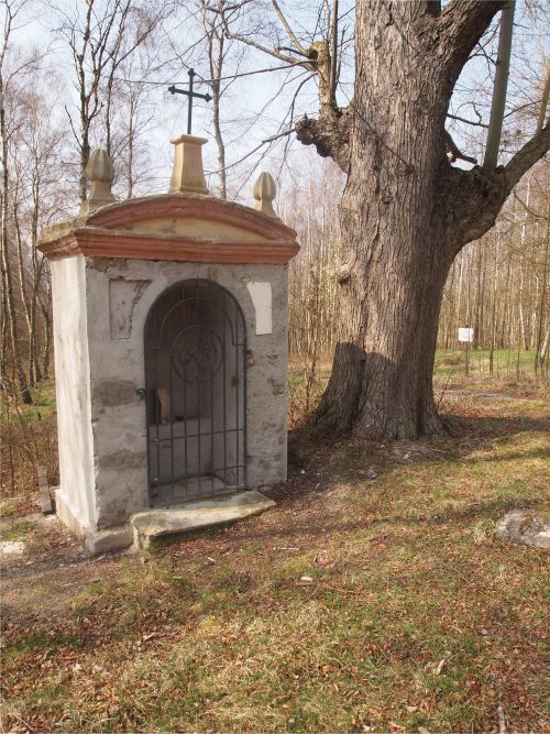
A stone chapel already mapped in 1715.
Because there was no church in such a small village, a chapel, which was first recorded in land-surveyors’ plans opposite the border tavern in 1600, was built. It was used until 1945, when the local residents were displaced.
Since 1951 there used to be a plough and a barbed wire fence with the surrounding buildings torn down. The border zone was canceled in 1967, but the chapel was ransacked - the painting of Virgin Mary and its iron gate was missing. Its reconstruction started later in 2001.
There are two rare linden trees close the chapel, where “Zur Linde” tavern used to stand, which are estimated to be 250-300 years old.
These trees are proclaimed to be natural monuments.
N: 50°48.602´ E: 014°00.653´
The Chapel in Rájec
A Monument Dedicated to Rock Climbers
- The Church of St.Anna
- Tisá Walls
- Promenade Walk “Perthenova cesta”
- The Memorial of the Victims of World War I.
- Tourist Cabin
- Kačák pond
- Cihlák pond
- Neuber’s Runied Tower
- Klement’s Cross
- Rájec Settlement
- The Chapel in Rájec
- A Monument Dedicated to Rock Climbers
- Ostrov
- The Cross at the Mill
- Iron Path (Železná cesta)
- The Rock Crevasse – Zwergloch (Dwarf’s cave)
- Border Stones – Ostrov
- Ostrov Spring
- Děčínský Sněžník
- Poor Sinner’s Cross
- Botschen Family Crypt
Interaktivní mapa
Můžete si otevřít mapu na mapy.cz a uložit do batůžku.
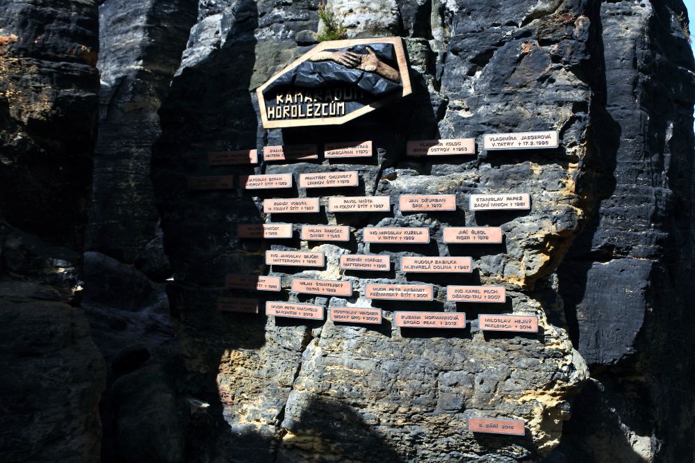
A monument dedicated to the rock climbers from our region that died while climbing rocks
It was exhibited on the 5th of September, 2015. It is located close the tourist trail from Tisá to Ostrov in the area called “Himmelreich”. Every year, visitors come here during the All Saints’ Day for a commemorative mass.
N: 50°47.676´ E: 014°02.668´
A Monument Dedicated to Rock Climbers
Ostrov
- The Church of St.Anna
- Tisá Walls
- Promenade Walk “Perthenova cesta”
- The Memorial of the Victims of World War I.
- Tourist Cabin
- Kačák pond
- Cihlák pond
- Neuber’s Runied Tower
- Klement’s Cross
- Rájec Settlement
- The Chapel in Rájec
- A Monument Dedicated to Rock Climbers
- Ostrov
- The Cross at the Mill
- Iron Path (Železná cesta)
- The Rock Crevasse – Zwergloch (Dwarf’s cave)
- Border Stones – Ostrov
- Ostrov Spring
- Děčínský Sněžník
- Poor Sinner’s Cross
- Botschen Family Crypt
Interaktivní mapa
Můžete si otevřít mapu na mapy.cz a uložit do batůžku.
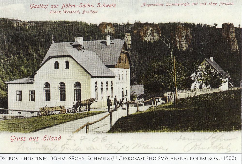
Ostrov - Eiland (450 - 455 m above sea level)
Is a settlement northwards from Tisá. It is located at the end of a long valley called “Bielatal”. Ostrov used to be a local industrial zone of sorts in as early as the 16th and 17th century. There used to be iron-mills, forge shops, saw-mills, grain-mills, and stone pits here, while both the fields and meadows were used for farming.
Nowadays we see that granting a fief, liberties and obligations safeguarded both the commerce and the tax liabilities. In 1706 Countess Marie Adelheid of Thun extended these liberties.
Nowadays, it is a recreation settlement with five ponds. The valley is flanked by sandstone rocks. It is accessible by a road or a tourist trail from the Tourist Cabin (Turistická chata). This destination is sought-after by rock climbers who can find a large number of climbing routes on hard sandstone.
N: 50°48.235´ E: 014°02.785´
Ostrov
The Cross at the Mill
- The Church of St.Anna
- Tisá Walls
- Promenade Walk “Perthenova cesta”
- The Memorial of the Victims of World War I.
- Tourist Cabin
- Kačák pond
- Cihlák pond
- Neuber’s Runied Tower
- Klement’s Cross
- Rájec Settlement
- The Chapel in Rájec
- A Monument Dedicated to Rock Climbers
- Ostrov
- The Cross at the Mill
- Iron Path (Železná cesta)
- The Rock Crevasse – Zwergloch (Dwarf’s cave)
- Border Stones – Ostrov
- Ostrov Spring
- Děčínský Sněžník
- Poor Sinner’s Cross
- Botschen Family Crypt
Interaktivní mapa
Můžete si otevřít mapu na mapy.cz a uložit do batůžku.
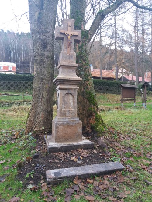
A sandstone cross with a plate painted silhouette of Christ
At the original road at the end of Ostrov was founded at the place of a ruined chapel in 1899. It was consecrated (together with the cross at the so called Fechtplane) on the 8th of October 1820. The village of Ostrov undertook to take care of its condition and maintenance on the 5th of October 1835. This is the start of “Železná cesta” (Iron Path).
N: 50°48.453´ E: 014°02.795´
The Cross at the Mill
Iron Path (Železná cesta)
- The Church of St.Anna
- Tisá Walls
- Promenade Walk “Perthenova cesta”
- The Memorial of the Victims of World War I.
- Tourist Cabin
- Kačák pond
- Cihlák pond
- Neuber’s Runied Tower
- Klement’s Cross
- Rájec Settlement
- The Chapel in Rájec
- A Monument Dedicated to Rock Climbers
- Ostrov
- The Cross at the Mill
- Iron Path (Železná cesta)
- The Rock Crevasse – Zwergloch (Dwarf’s cave)
- Border Stones – Ostrov
- Ostrov Spring
- Děčínský Sněžník
- Poor Sinner’s Cross
- Botschen Family Crypt
Interaktivní mapa
Můžete si otevřít mapu na mapy.cz a uložit do batůžku.
Remains of iron ore mining.
There are several places around Ostrov with noticeable remains of iron ore mining. This path used to serve for the transportation of iron products from iron-mills in Ostrov and it lead towards Rájec and then turned left on the summit of the hill. Iron chips can be found here even today. Coordinates - Iron path, i.e. from the cross to the chapel.
N: 50°48.453´ E: 014°02.795´
Iron Path
The Rock Crevasse - Zwergloch (Dwarf’s cave)
- The Church of St.Anna
- Tisá Walls
- Promenade Walk “Perthenova cesta”
- The Memorial of the Victims of World War I.
- Tourist Cabin
- Kačák pond
- Cihlák pond
- Neuber’s Runied Tower
- Klement’s Cross
- Rájec Settlement
- The Chapel in Rájec
- A Monument Dedicated to Rock Climbers
- Ostrov
- The Cross at the Mill
- Iron Path (Železná cesta)
- The Rock Crevasse – Zwergloch (Dwarf’s cave)
- Border Stones – Ostrov
- Ostrov Spring
- Děčínský Sněžník
- Poor Sinner’s Cross
- Botschen Family Crypt
Interaktivní mapa
Můžete si otevřít mapu na mapy.cz a uložit do batůžku.
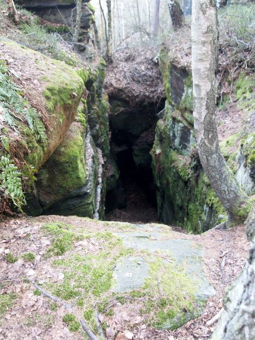
A natural crevasse on the state border between Germany and Czechia
At the boundary stone No. 20/15 used to be mentioned in all historic border logs as a significant reference landmark. It is mentioned even in the oldest know map of the area surrounding Ostrov (Oeder – Zimmermann, 1614 – 1634). It is said that it used to serve as a smugglers’ hideout.
During the period of closed border zone the border guards were trying to fill it up, because they thought that it lead up to Germany. After the border zone was abandoned the rock climbers made it accessible again.
N: 50°48.639´ E: 014°02.486´
The Rock Crevasse
Border Stones – Ostrov
- The Church of St.Anna
- Tisá Walls
- Promenade Walk “Perthenova cesta”
- The Memorial of the Victims of World War I.
- Tourist Cabin
- Kačák pond
- Cihlák pond
- Neuber’s Runied Tower
- Klement’s Cross
- Rájec Settlement
- The Chapel in Rájec
- A Monument Dedicated to Rock Climbers
- Ostrov
- The Cross at the Mill
- Iron Path (Železná cesta)
- The Rock Crevasse – Zwergloch (Dwarf’s cave)
- Border Stones – Ostrov
- Ostrov Spring
- Děčínský Sněžník
- Poor Sinner’s Cross
- Botschen Family Crypt
Interaktivní mapa
Můžete si otevřít mapu na mapy.cz a uložit do batůžku.
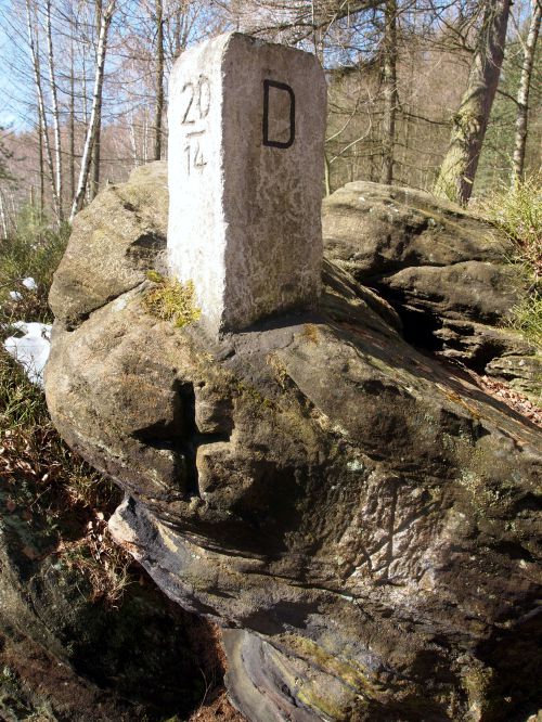
There used to be three contestable forests
At the municipal border between Rájec and Sněžník: Grosse Kriegholz (Large contestable forest, also known as Old), Das alte Kriegholz, between Ostrov and Rájec), Kleine Kriegholz (Small contstable forest between Ostrov and Sněžník) and Neue Kriegholz (New contestable forest at Rájec).
In 1537 the border stones were mentioned - including the boulder (nowadays a border stone No. 20/14) with cut-out cross and crossed swords of the Saxon Electorate.
N: 50°48.636´ E: 014°02.538
Border Stones – Ostrov
Ostrov Spring
- The Church of St.Anna
- Tisá Walls
- Promenade Walk “Perthenova cesta”
- The Memorial of the Victims of World War I.
- Tourist Cabin
- Kačák pond
- Cihlák pond
- Neuber’s Runied Tower
- Klement’s Cross
- Rájec Settlement
- The Chapel in Rájec
- A Monument Dedicated to Rock Climbers
- Ostrov
- The Cross at the Mill
- Iron Path (Železná cesta)
- The Rock Crevasse – Zwergloch (Dwarf’s cave)
- Border Stones – Ostrov
- Ostrov Spring
- Děčínský Sněžník
- Poor Sinner’s Cross
- Botschen Family Crypt
Interaktivní mapa
Můžete si otevřít mapu na mapy.cz a uložit do batůžku.
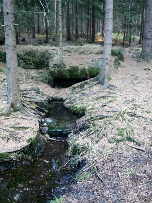
A spring rises
On the left side of the path along the state border to Saxony. Its water is said to be “miraculous” and have rejuvenating properties. Its German name used to be "Zehrbrunn", which can be roughly translated as “the fountain of youth".
The spring rises next to the path and the water comes from the underground of the rocks above the path. The spring water soon runs into the Bělá stream in Ostrov. The local ruler, Countess Marie Adelheid of Thun, used to have the water from the spring delivered to her.
N: 50°48.646´ E: 014°03.024´
Ostrov Spring
Děčínský Sněžník
- The Church of St.Anna
- Tisá Walls
- Promenade Walk “Perthenova cesta”
- The Memorial of the Victims of World War I.
- Tourist Cabin
- Kačák pond
- Cihlák pond
- Neuber’s Runied Tower
- Klement’s Cross
- Rájec Settlement
- The Chapel in Rájec
- A Monument Dedicated to Rock Climbers
- Ostrov
- The Cross at the Mill
- Iron Path (Železná cesta)
- The Rock Crevasse – Zwergloch (Dwarf’s cave)
- Border Stones – Ostrov
- Ostrov Spring
- Děčínský Sněžník
- Poor Sinner’s Cross
- Botschen Family Crypt
Interaktivní mapa
Můžete si otevřít mapu na mapy.cz a uložit do batůžku.
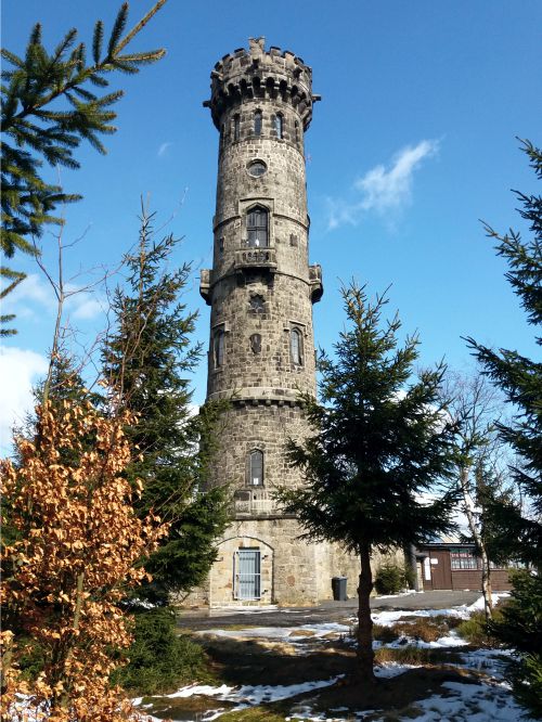
The outlook tower of Děčínský Sněžník
Is located eastwards from Tisá on the highest mesa in Czechia (723 m above sea level). It can offer captivating views of the Lusatian Mountains and the Bohemian-Saxon Switzerland.
Thanks to the thermal lifts around the mesa air currents from as far as the North Sea mix here. Their beneficial effect caused this place to be called “Wind Spa”.
The stone tower was built by Count Fantišek Thun in 1864 according to the plans by architect Hanel. Originally, it served as a triangulation point, but later it served also as an outlook tower. The following year, 1865, a tavern was established here.
This place was the first in our country where they were able to tune in the signal from the Olympics held in Berlin in 1936. The tower was repeatedly reconstructed in 1996 and 2016.
N 50°47.4945', E 014°6.2329'
Děčínský Sněžník
Poor Sinner’s Cross.
- The Church of St.Anna
- Tisá Walls
- Promenade Walk “Perthenova cesta”
- The Memorial of the Victims of World War I.
- Tourist Cabin
- Kačák pond
- Cihlák pond
- Neuber’s Runied Tower
- Klement’s Cross
- Rájec Settlement
- The Chapel in Rájec
- A Monument Dedicated to Rock Climbers
- Ostrov
- The Cross at the Mill
- Iron Path (Železná cesta)
- The Rock Crevasse – Zwergloch (Dwarf’s cave)
- Border Stones – Ostrov
- Ostrov Spring
- Děčínský Sněžník
- Poor Sinner’s Cross
- Botschen Family Crypt
Interaktivní mapa
Můžete si otevřít mapu na mapy.cz a uložit do batůžku.
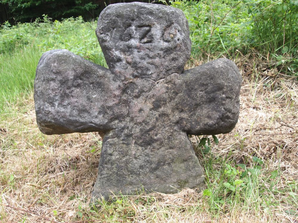
Last preserved Sinner’s Cross.
Out of many sinners’ crosses in the vicinity only one cross has been preserved at the road in Nový Libouchec. It was built close to the former roadside inn, where it is said a wandering essence peddler was killed and robbed. The sandstone cuneiform cross has an incised year of 1626 on both sides. The valley used to be called “Tyssloch” (Tisá’s den) and there used to be three inns along the road to Tisá.
N: 50°46.399´ E: 014°02.387´
Poor Sinner’s Cross.
Botschen Family Crypt
- The Church of St.Anna
- Tisá Walls
- Promenade Walk “Perthenova cesta”
- The Memorial of the Victims of World War I.
- Tourist Cabin
- Kačák pond
- Cihlák pond
- Neuber’s Runied Tower
- Klement’s Cross
- Rájec Settlement
- The Chapel in Rájec
- A Monument Dedicated to Rock Climbers
- Ostrov
- The Cross at the Mill
- Iron Path (Železná cesta)
- The Rock Crevasse – Zwergloch (Dwarf’s cave)
- Border Stones – Ostrov
- Ostrov Spring
- Děčínský Sněžník
- Poor Sinner’s Cross
- Botschen Family Crypt
Interaktivní mapa
Můžete si otevřít mapu na mapy.cz a uložit do batůžku.
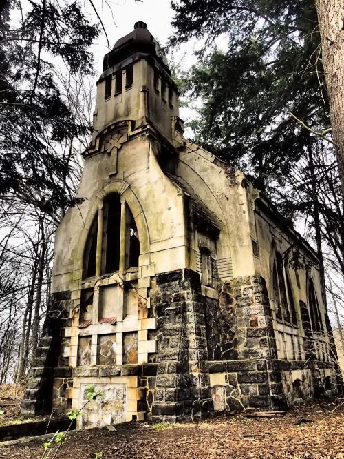
Jedna z prvních secesních staveb v okolí
The owner of a velvet manufacture in Libouchec, Friedrich Wilhelm Botschen, had a family crypt built on the hill above the village in 1899 - 1900. The crypt consisted of a secession chapel with a bell-tower. The burial-ground itself was located in its basement.
The construction finished on the 27th of January 1900 as one of the first secession building projects in the area. The crypt was ransacked and damaged in the past. Recently, new adjustments were done to the surrounding area in order to prevent the entry of undesirable persons.


